1848 - 1878: Mexican Cession and Rancho Santa Anita Subdivision
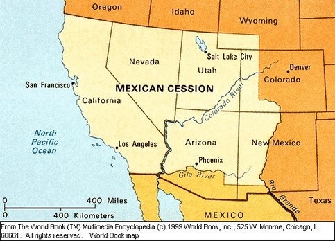
Mexican Cession Boundaries
Credit: World Book Encyclopedia
Following the end of the Mexican-American War in 1848 Alta California was ceded by Mexico and became part of the United States. The Treaty Of Guadalupe Hildago provided that pre-war Mexican land grants would be honored, and Henry Dalton filed a claim for Rancho Santa Anita with the U.S. Public Land Commission in 1852.
Given the size of the cession and the many competing claims it took the U.S. Supreme Court until 1865 to confirm all of the grants. Records from the Huntington Library show overlapping and sometimes conflicting transfers of Rancho Santa Anita land during this time, before Dalton's grant was finally patented in 1866:
- Equestrian and circus owner Joseph Andrew Rowe is said to have purchased the Rancho in 1854 for $33,000 (approximately $1 million adjusted for inflation), gone bankrupt in 1856, and lived on the Rancho until 1858. A 1857 survey indicates Rowe as the sole owner while also showing the first subdivisions, in the western area that would become Pasadena.
- Albert Dibblee and William Corbett are said to have purchased the Rancho in its entirety in 1858. A July 1858 survey indicates Henry Dalton as the sole owner while also showing the subdivisions -- including the Chapman Tract -- that would become Pasadena. E.H. Head and Elias "Lucky" Baldwin later purchased the eastern portions of the Rancho, which would become Arcadia.
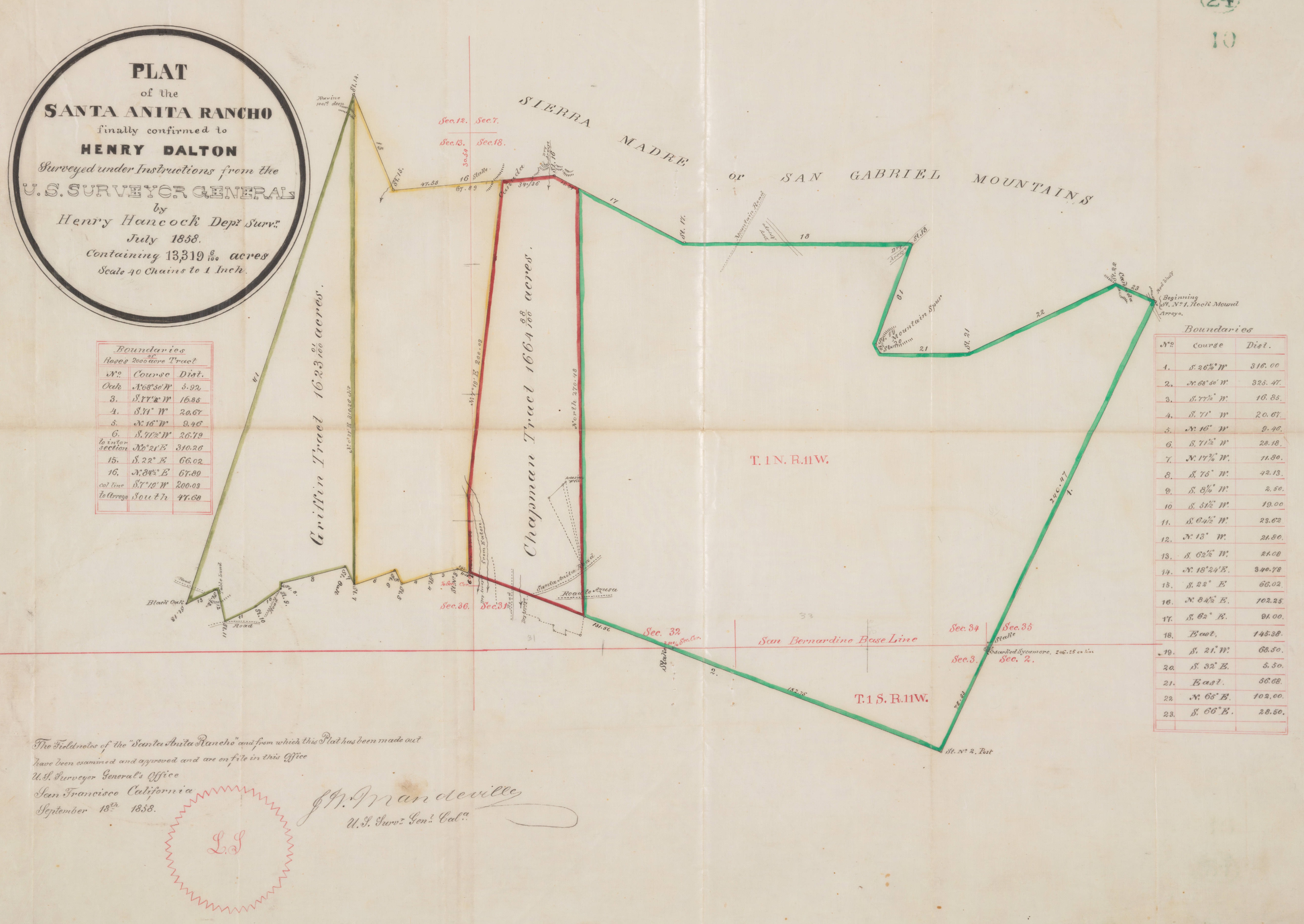
1858 Survey of Rancho Santa Anita showing subdivisions
Source: The Huntington Library
The Chapman tract first appears in Henry Dalton's 1858 survey of the Rancho. Using modern landmarks, the approximate corners of the tract were:
- NW: Hastings Ranch Dr. & Ranch Top Rd. (Hastings Ranch)
- NE: Michillinda Ave. & Carriage House Rd. (Hastings Ranch)
- SW: Lombardy Rd. @ Eaton Wash (Chapman Woods)
- SE: Duarte Rd. & Oak Ave. (Arcadia / San Gabriel border)
The "dry arroyo from Eaton" (modern-day Eaton Canyon Wash) can be seen at the south-west corner, and modern-day Michillinda Avenue represents the entire eastern border.